+975 77 73 17 98
[email protected]


Jomolhari Trek I / Max. Elevation: 4,930m
Duration: Nine days,
Highest Camp: 4,080m
Standard: Medium
Best Seasons: March to June & October to November
Start: Drukgyel Dzong (Paro)
Finish: Dodena (Thimphu)
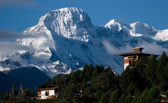
Summary: Jomolhari Trek – Jomolhari Trek I is the longer one of the two Jomolhari routes- and the most popular trek in Bhutan. With altitude differences of 2,500m and nearly 5,000m (lowest and highest point of the route), it offers a wide range of landscape, fauna and flora. The highlight of this trek is the spectacular view of Mount Jomolhari from Jomolhari Basecamp, Jangothang. Nearly the whole trek goes through a small part of the Jigme Singye National Park, passing a few of the Yak herder’s settlement and the remotest region of Lingshi. One should be reasonably physically fit to enjoy the majestic mountain views, endure thin air, serenity & the wilderness of the landscape while on the trek.
Paro International Airport (Google Map)


Drive up to Drukgyel Dzong (2,580m) where the road ends and the trek begins with a gradual climb the trail follows the Paro Chhu passing beautiful meadows, paddy fields and impressive farm houses. After about four hours you will reach the army post at Gunitsawa village. At the army check post your trek permit (provided by your tour operator) will be checked and endorsed. The campsite is on the opposite side of the river, not far from Gunitsawa.
On this long day, the trail continues with lots of small ups and downs. After going uphill through the river valley, you enter the Jigme Dorji National Park. The valley finally narrows gradually to a mere path, which descends to a meadow where a camp will be set up. From here, if weather permits, you will have the first great view of Mount Jomolhari.
If you did not see Mount Jomolhari last evening, you will have a great chance to get a great view this early morning. This morning the trek continues up the Paro Chhu valley, which widens into patches of alpine meadow and scanty growths of forest. Cross an army outpost along the way and enjoy a spectacular view of high mountain ridges and snow-capped peaks. Yaks and the herder’s homes become a regular feature of the landscape. Passing the villages Soe, Takethang and Dangochang is another asset on this day. Reaching Jangothang, one of the most beautiful campsites of the Himalayas, you will again have a spectacular view of Mount Jomolhari.
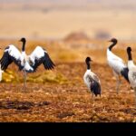
The day in Jangothang provides plenty of possibilities for day hikes with great views on lakes and snow capped mountains such as Jomolhari and Jichu Drake. There are good chances to spot some blue sheep on the upper slopes of the valley. Jangothang is a perfect environment for your acclimatisation. Trek up to Tosoh or hike around the area. There are good short hiking trails in three directions. Jumolhari and it’s subsidiary mountain chains lie directly west, Jichu Drake to the north and a number of unclimbed peaks to the east.
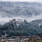
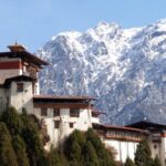
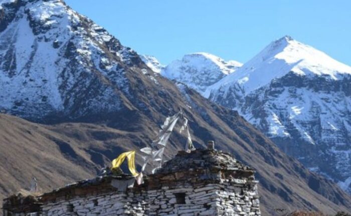
After 15 min. from the camp the trail climbs rapidly for about half an hour and then becomes a gradual ascend to the Nyilila pass at 4,870m. While on the climb enjoy the surrounding. You might see herds of blue sheep grazing on the slopes of the mountains. From the pass you will have spectacular views of Mt. Jomolhari, Jichu Drake and Tsherimgang, all of them rising above 7,000m. On the way down to the camp you will pass by some of the yak herder’s tent, made from yak wool, where the herders take shelter while on the move to various pastures for their yaks. As you come down into the Lingshi basin, you get a wonderful view of Lingshi Dzong on a clear day. Tserimgang and its glaciers rise up at the north end of the valley. The campsite is next to a stone hut you reach just before Lingshi Dzong.
The trail climbs up to the Yelila pass at an altitude of 4,930m. From the pass, on a clear day you will get an excellent view of Jumolhari, Tserimgang and Masanggang. The trek from the pass to the campsite at Shodu is a steep downhill.
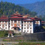
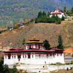
The trail follows the Thimphu Chhu through rhododendron forests, past beautiful waterfalls along the way. The valley narrows till the path takes to the slopes and gradually ascends to the ruins of Barshong Dzong.
The trail descends down to the Thimphu Chhu river valley, through dense forests of rhododendron, birch, conifer, maples and bamboos and then ascends to pasture lands. The camp is in a meadow.
The trail continues through forested areas winding up and down and through a small pass. Langurs (monkeys) can be seen along the way. In Dodena, you will exit the Jigme Dorji National Park and reach the road head next to a impressive cantilever bridge.